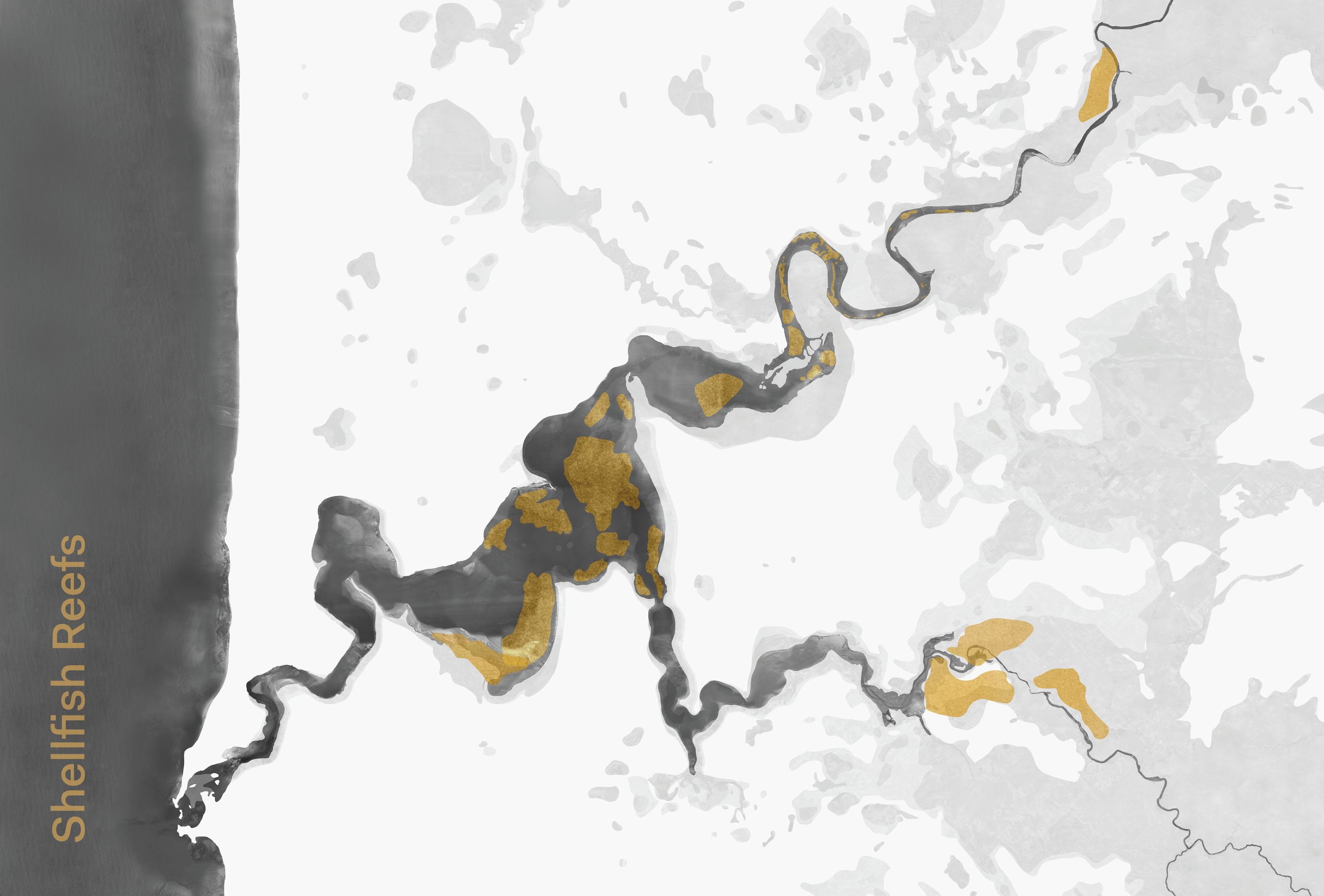
Bilya Shellfish Reef Restoration
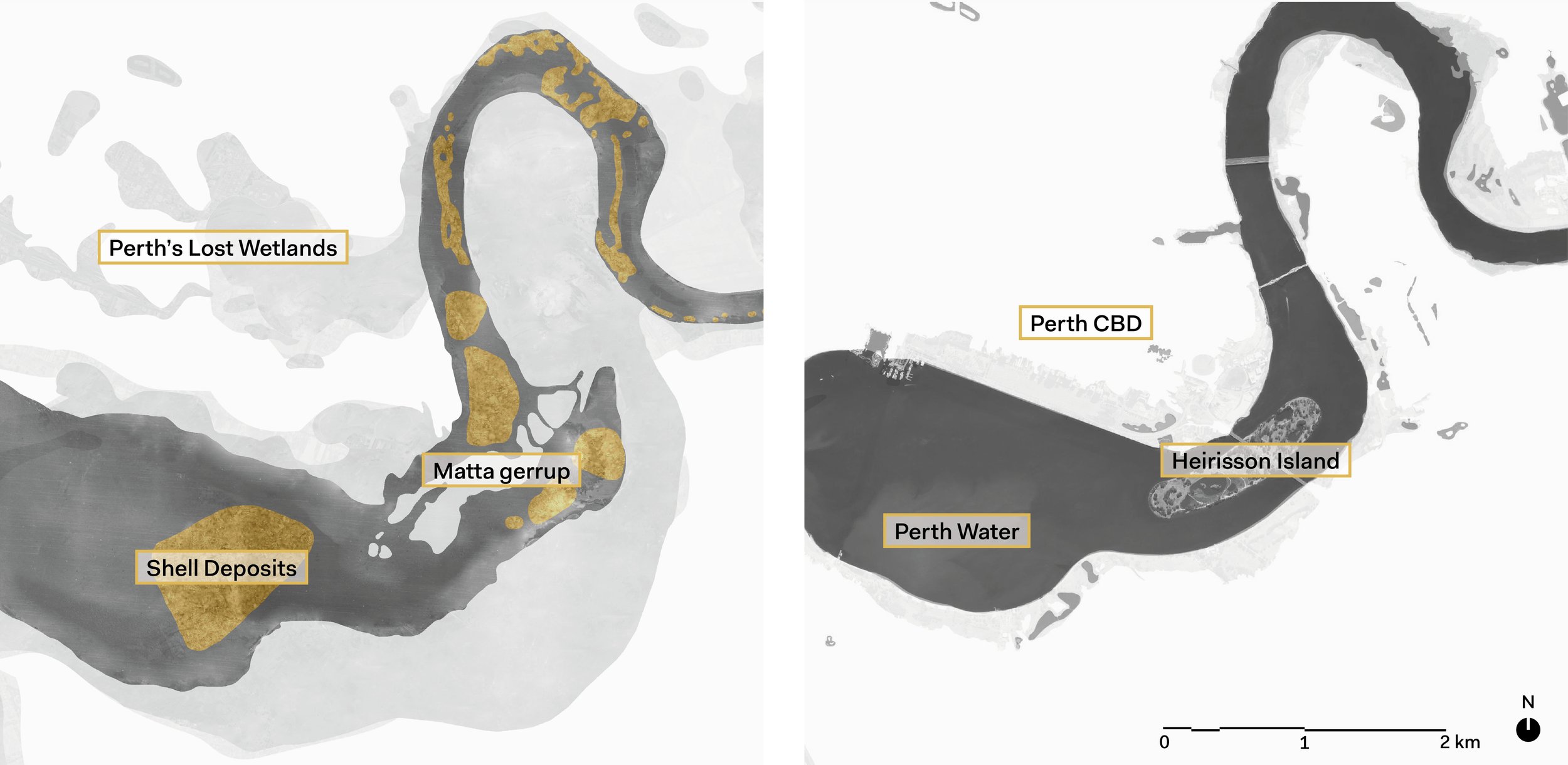
Through contemporary and archival mapping, this project made visible the ancient and lost shellfish reefs of the Bilya – Swan-Canning Estuary to inform contemporary ecological restoration work being undertaken by The Nature Conservancy.
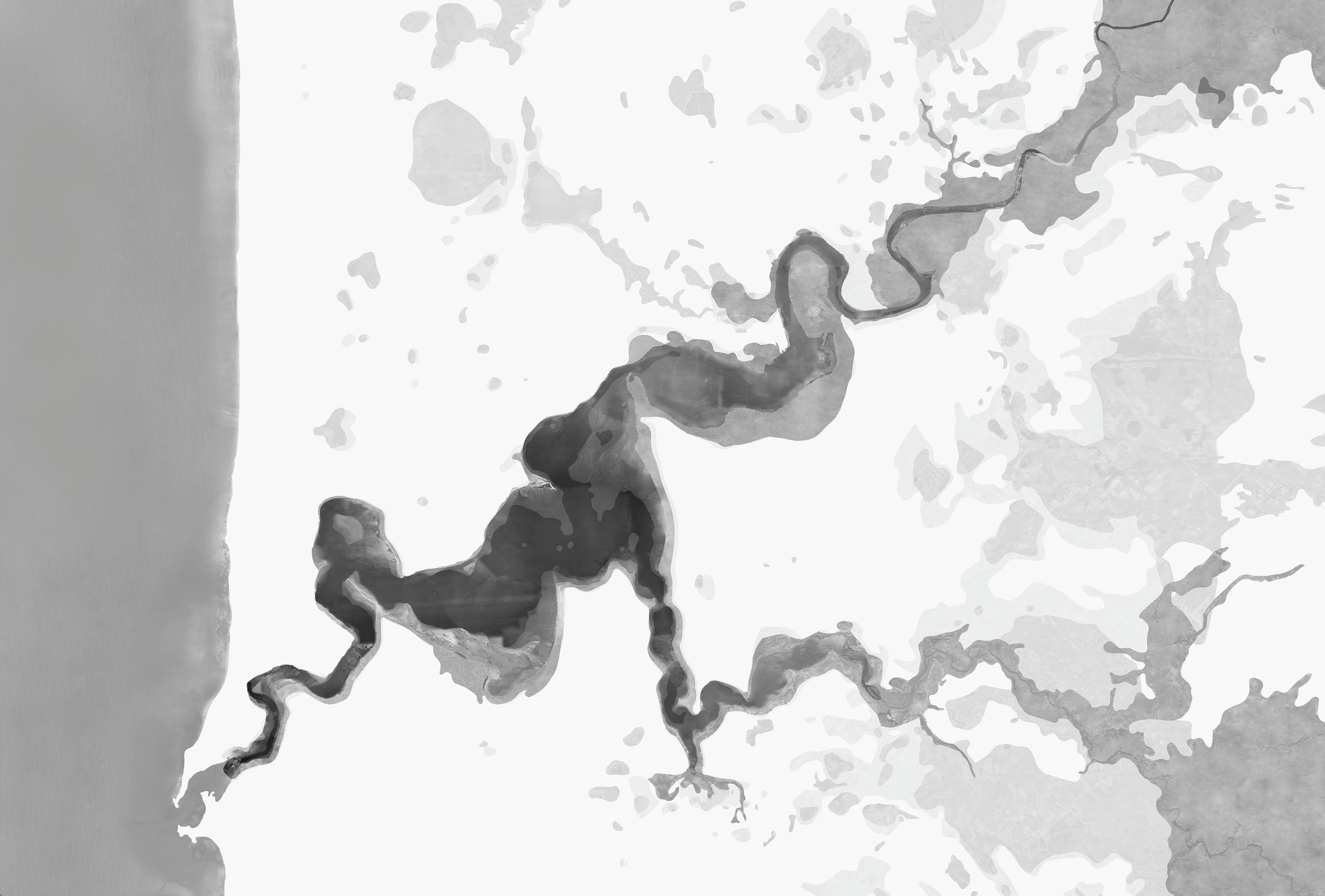
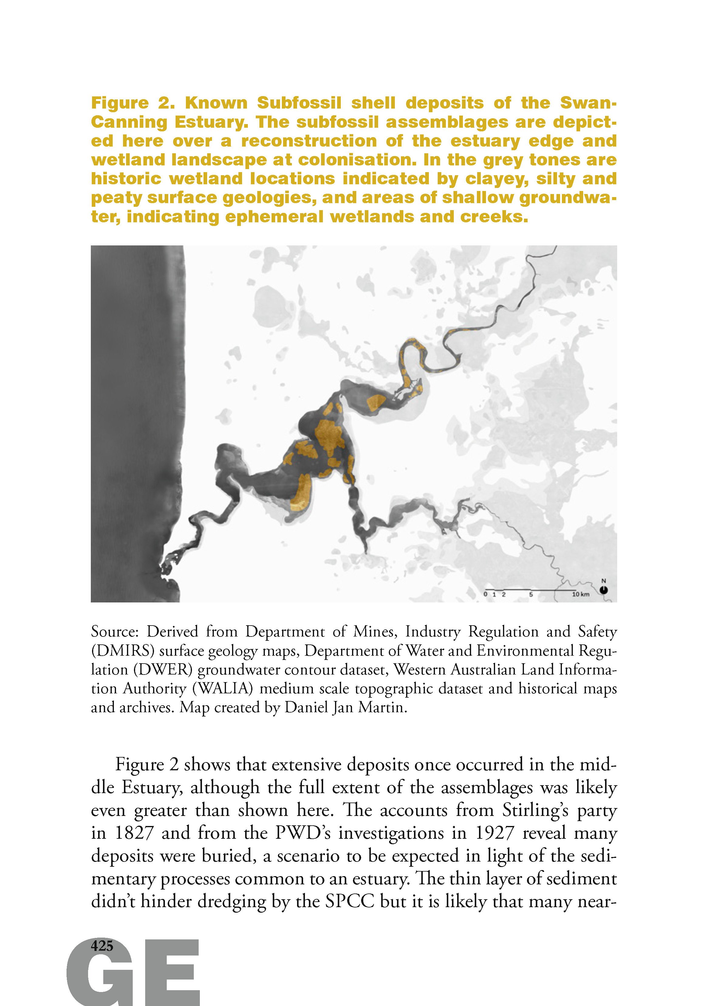
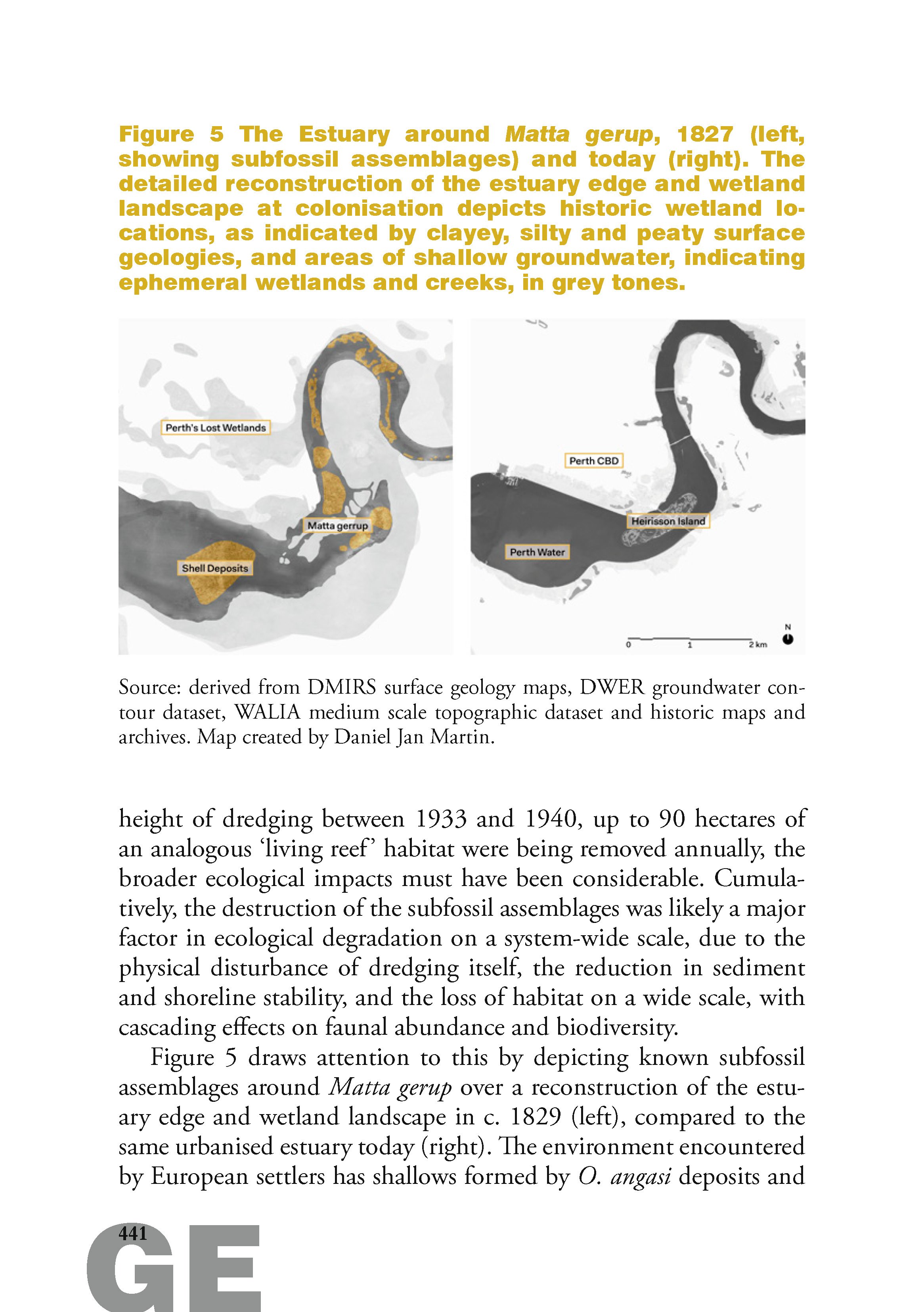
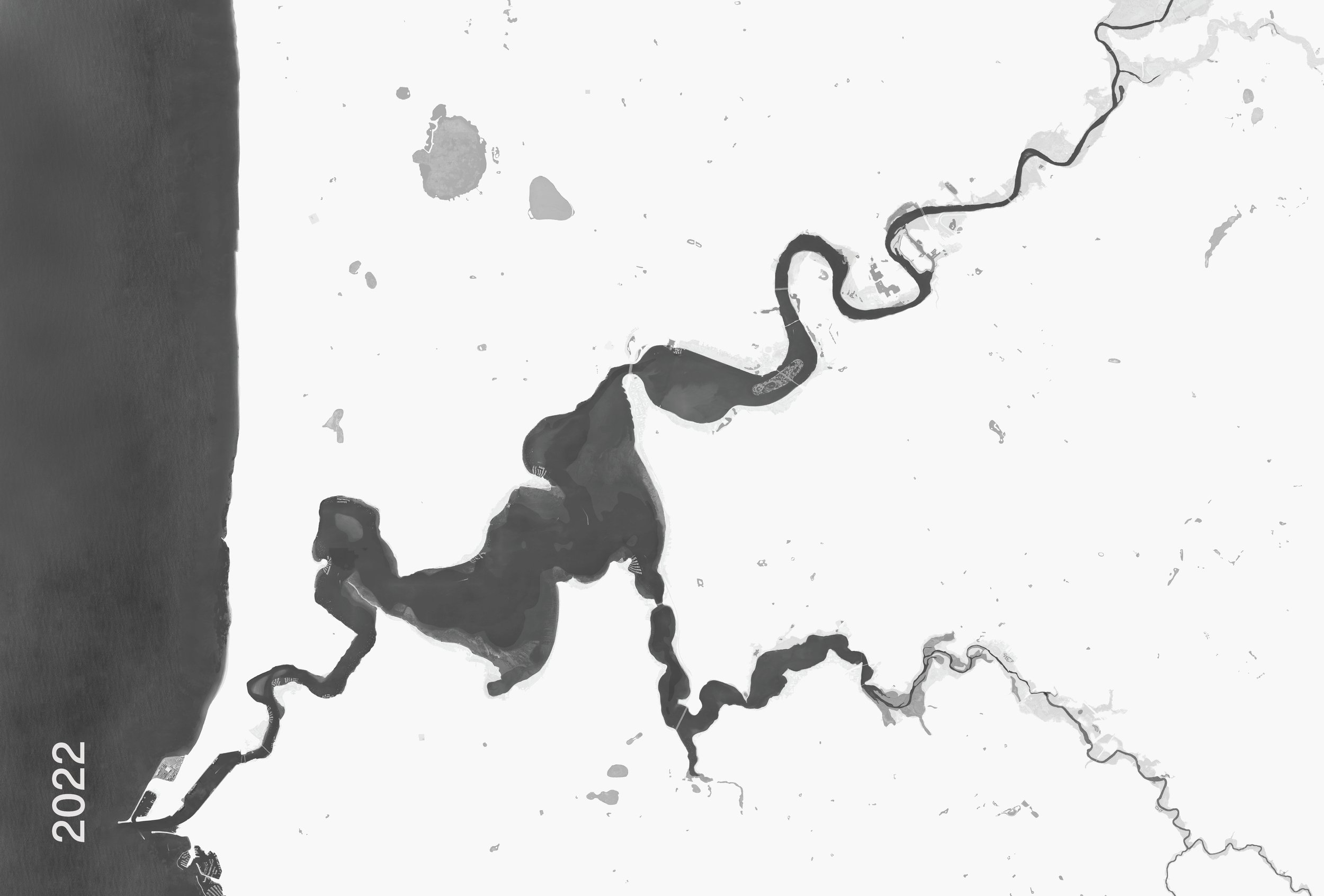
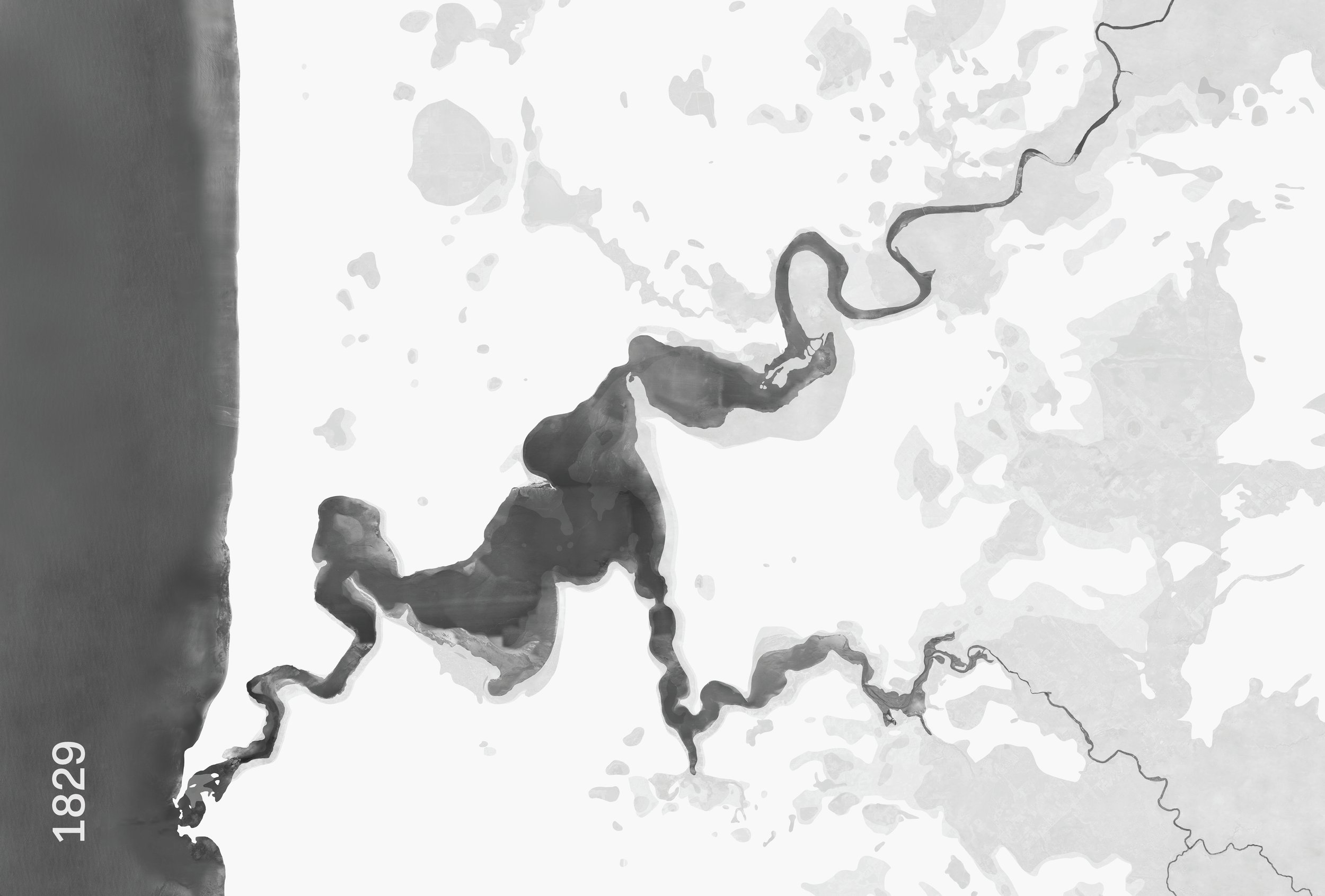
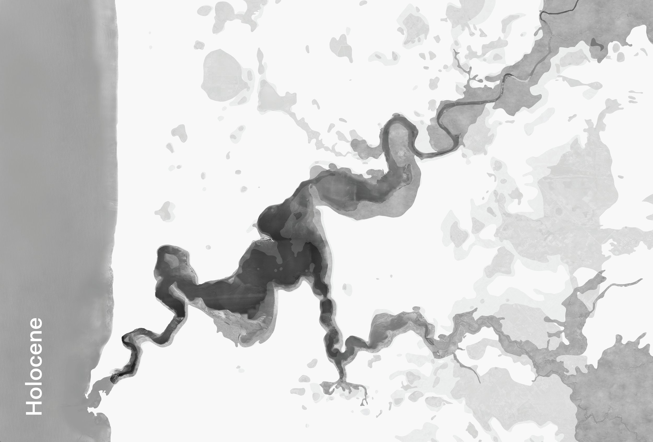
Through deep dives into the State Records Office and environmental datasets, a picture of the Bilya’s edge at three time periods emerged: in the Holocene; at 1829; and at 2022.
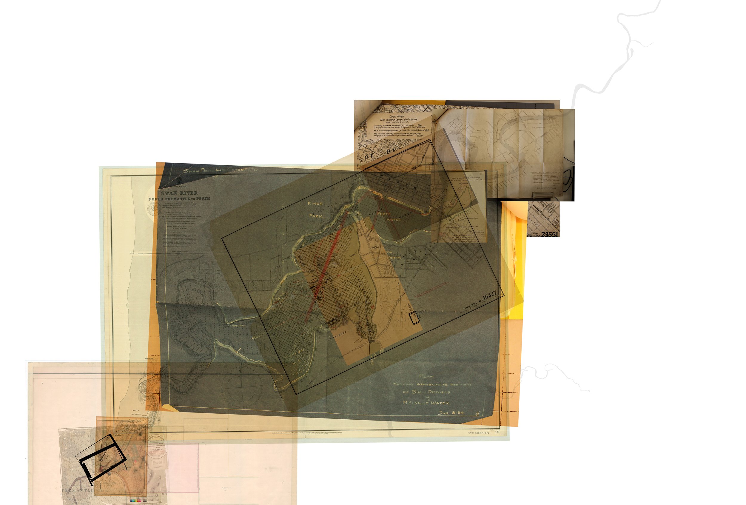
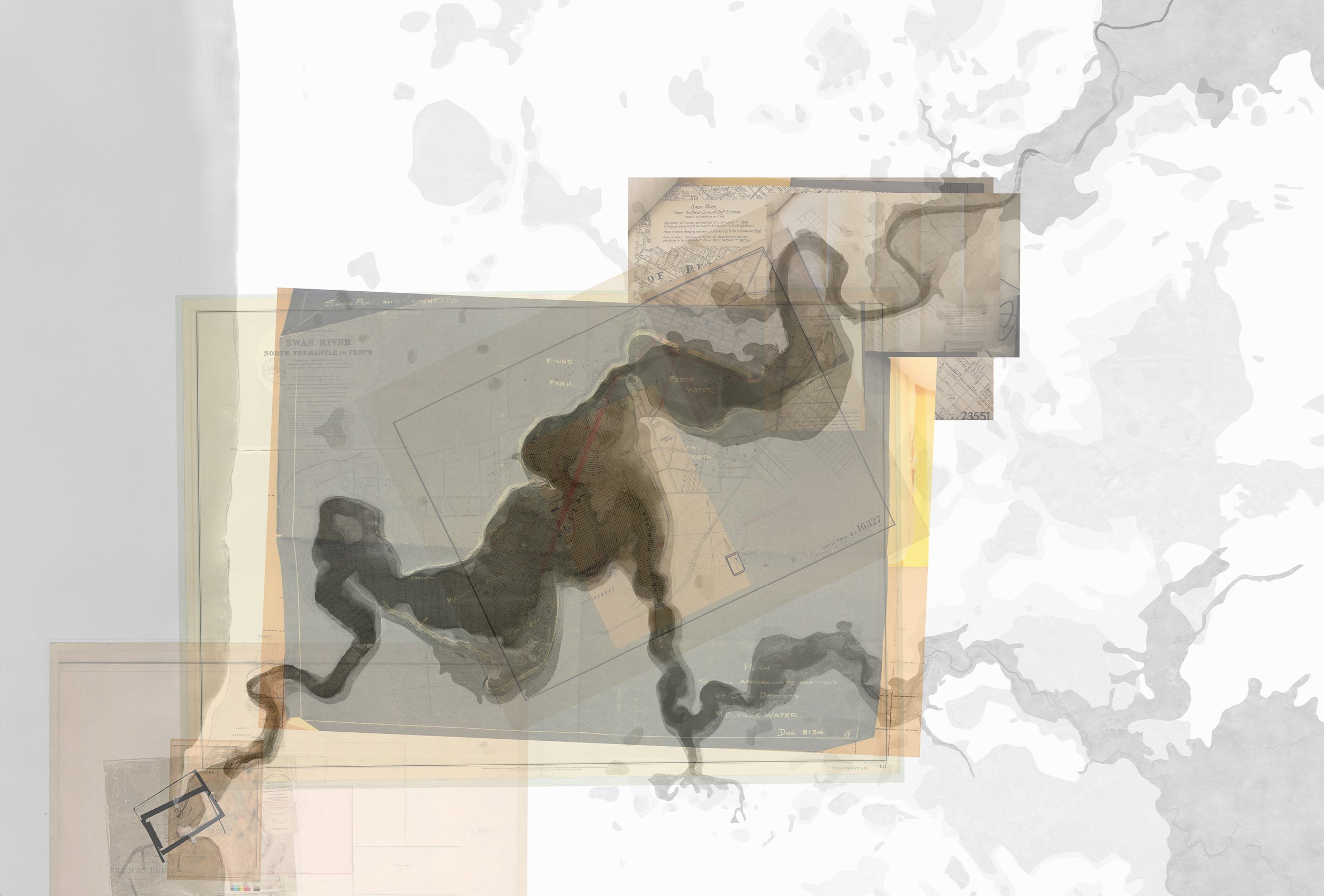
Typical of the colonial treatment of Australian urban river systems, the form of the river has been drastically modified over time. Hard river edges and steep walls were constructed to control seasonal ebbs, flows and inundations. Seasonal sandbars were dredged and limestone cliffs exploded to construct the Fremantle Port and enable shipping. Large foreshores of the Swan-Canning Estuary were reclaimed for recreation and development.
The dredging of shellfish reefs formed part of this project. Various maps and records of oyster reef dredging were analysed along with historical bathymetries to reconstruct the locations of the vast reef systems which once covered much of the Bilya.
Read our journal article in Global Environment
Read about work by The Nature Conservancy to rebuild Australia’s lost shellfish reefs
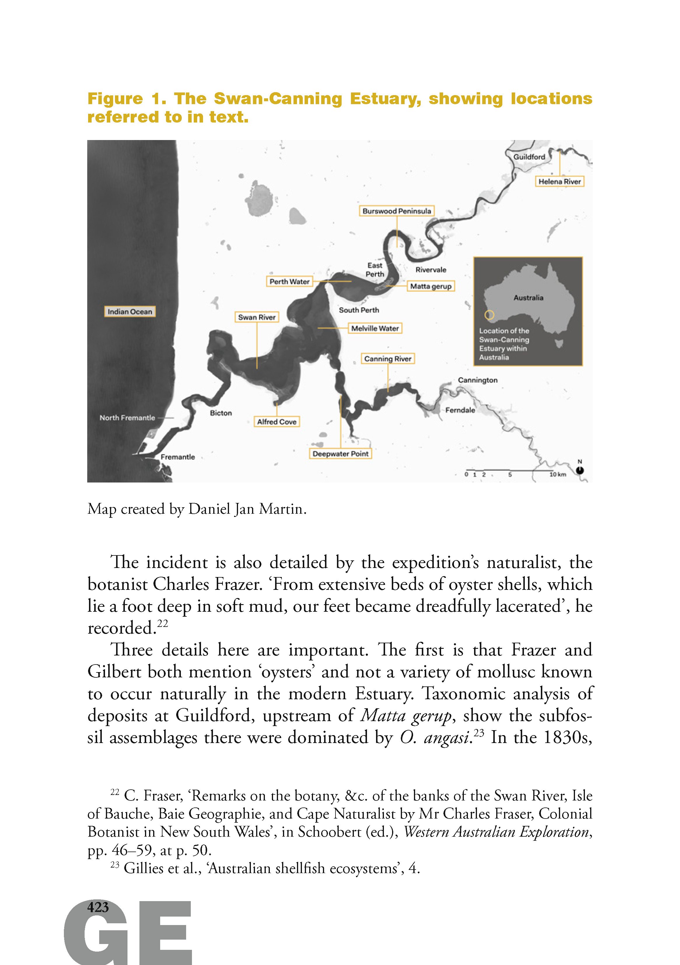
Mapping
2022
Role
Co-investigator with Joseph Christensen
Client
The Nature Conservancy
Ecosystem restoration; Historical ecology; Archival research; Mapping